Decades of effort revitalize St. Louis River
Work to mediate more than 100 years of industrial pollution and dumping in Duluth, Minn., has reached new milestones.
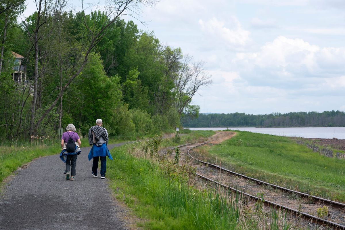
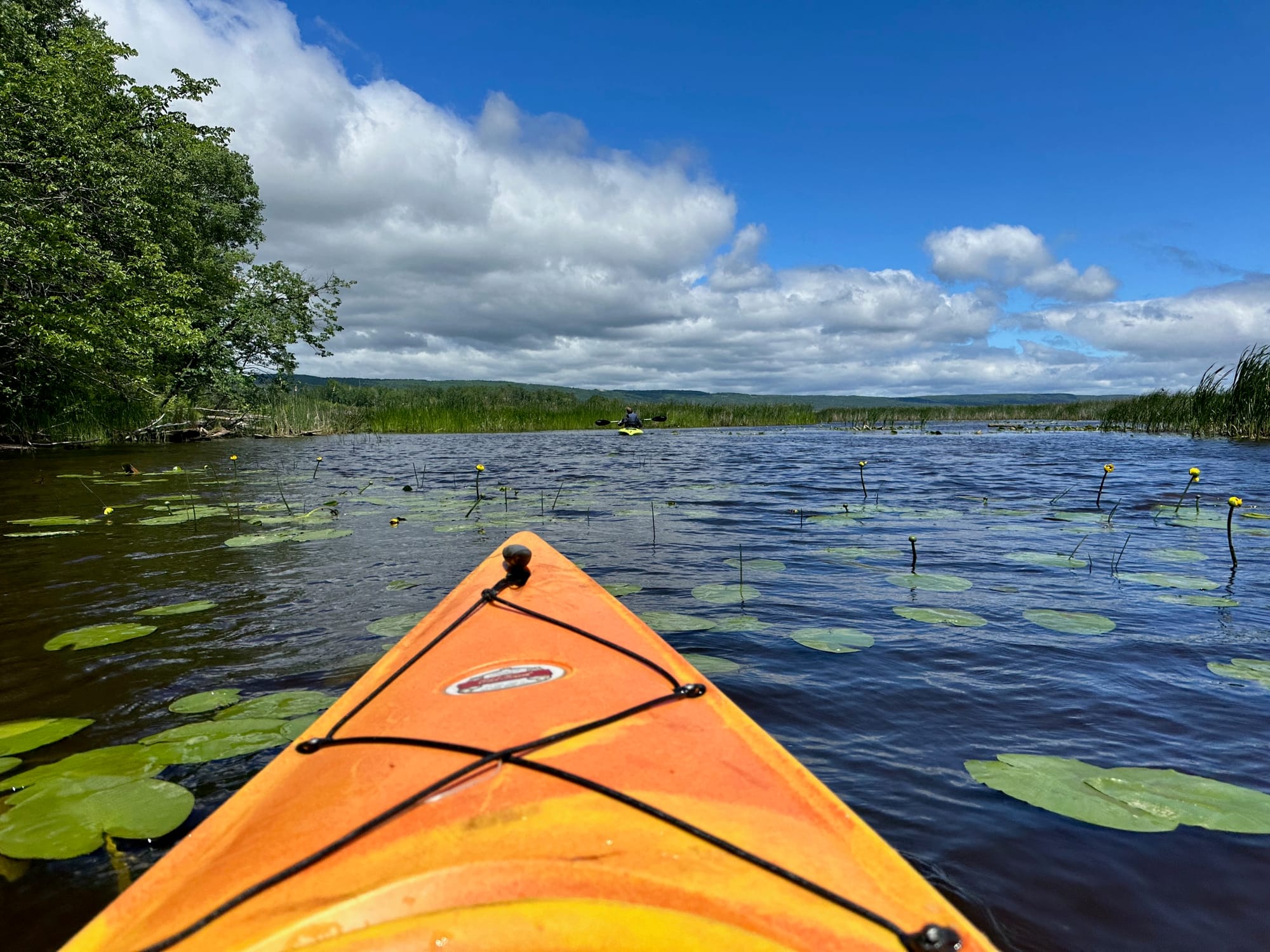
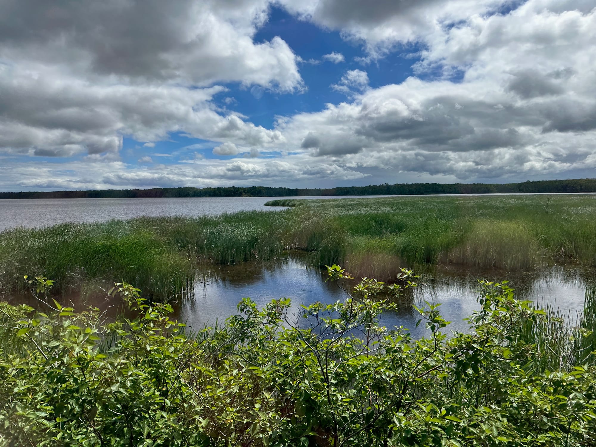
DULUTH, Minn — On a quiet early summer morning, moody clouds drift across the sky and wind riffles tufts of wild rice emerging from cleaned-up shallows of the St. Louis River. Two kayaks add a pop of orange and yellow to the wide expanse of water as the historic Lake Superior and Mississippi Railroad scenic train hugs the shoreline on its way back to Duluth.
While many travelers have felt the St. Louis River thunder beneath the swinging suspension bridge at Jay Cooke State Park in Carlton about 20 miles away or glimpsed its distant shimmer from overlooks at Skyline Drive, Enger Tower, or the Thompson Hill Rest Area, few have experienced the river up close. It flows from the Fond du Lac Dam through western Duluth into Lake Superior and provides a 12,000-acre freshwater estuary.
That’s changing quickly as decades of work to mediate more than 100 years of industrial pollution and dumping has reached new milestones. The river was designated a National Water Trail by the National Park Service in 2020 and officials opened a new section of the Waabizheshikana (Marten) Trail along the shore. The almost 5-mile shoreline trail will eventually double in length.
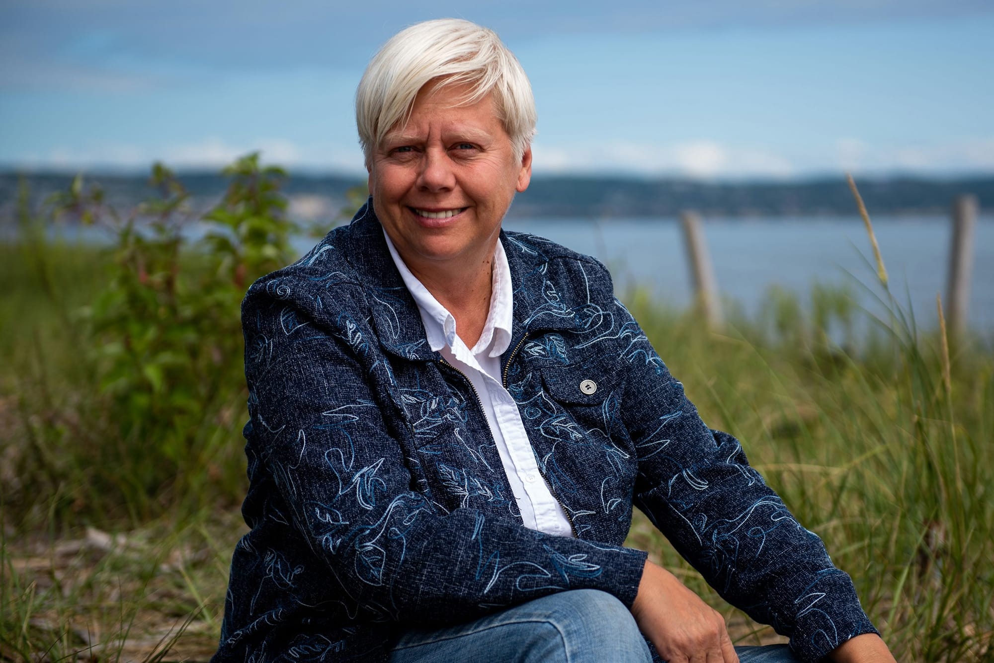
“It’s taken 30-some years to come up with a plan, do the testing, figure out what needs to be remediated and restored,” said Kris Eilers, executive director of the St. Louis River Alliance. “It’s now a designated National Water Trail. That’s only possible because it’s cleaner.”
Reconnecting people to the river
The St. Louis River Alliance’s brochures help introduce people to the river with a map of its numerous bays, islands and even lakes. It includes 11 paddling loops and offers cultural history and information on some of the river’s industrial history, and the Fond du Lac Band of Lake Superior Chippewa, which was heavily involved in restoration work.
The alliance began in the 1980s when the river’s legacy of pollution led officials to flag it as a national Area of Concern for the Great Lakes region.
Longtime locals, such as Charlie Stauduhar, owner of Spirit Lake Marina, grew up in the 1960s and 1970s, when the St. Louis was considered “a cesspool” after decades of heavy industry — including lumber mills, a steel plant and a shipbuilder — all preceding any clean water protection laws.
U.S. Steel, which provided jobs for West Duluth’s working-class families from 1915 to 1981, had been boarded up and deemed a Superfund site, making it the largest and most complex contamination removal project along Spirit Lake, a 200-acre widening of the St. Louis River. It required three years and more than $165 million to clean up what’s now 92 acres of green space with native plantings and trails.

“We expected the opening of the U.S. Steel site would be popular, but we’re seeing activity there every day,” Knettel said, and its Morgan Park neighborhood has been a hub for new recreational programming.
His staff has been working with a National Park Service employee based in Duluth’s parks office to provide low and no-cost activities for underserved youth that will introduce them to fishing, birding, hiking, and how-to paddling programs along the river, all of which have had great turnouts.
Upcoming projects along the St. Louis will include more public water accesses, fishing piers, and trailhead access points as the Waabizheshikana Trail is extended.
As more people are seeing the river up close—many for the first time—through walks along trails, paddling loops, or excursions on the historic Lake Superior and Mississippi Railroad, the positive effect of its cleanup is energizing the neighborhoods along its shores.
The RiverWest development between the river and Spirit Mountain Recreation Area opened last summer with a Ski Hut Adventure Center with bike and ski rentals, a Burnett Dairy Cheese Store with picnic foods and pizzas, and new vacation townhomes with two to four bedrooms that bring travelers closer to the river.
“[The St. Louis] riverfront] is going to really start to take off and become a destination for people not only in our city but from outside the area,” Knettel said. “[Duluth is] an outdoor hub and the cleanup of the estuary is going to make that more significant.”
Wild rice, wildlife return
Bright green stalks of wild rice, or manoomin, a sacred food for the Ojibwe, wave in the breeze in the St. Louis River shallows. Over a decade of work, 275 acres were restored.
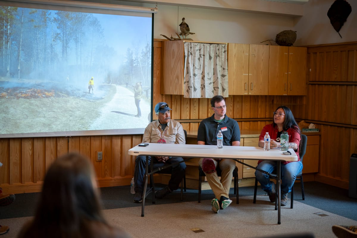
Trailside interpretive signs and story poles are in the works to highlight Ojibwe migration and culture; trading and treaties; the rise of railroads and lumberyards; shipbuilders and steelworkers; the stories of often overlooked immigrants, Native Americans and people of mixed races who worked at the factories; and the animals and plants that inhabit the estuary.
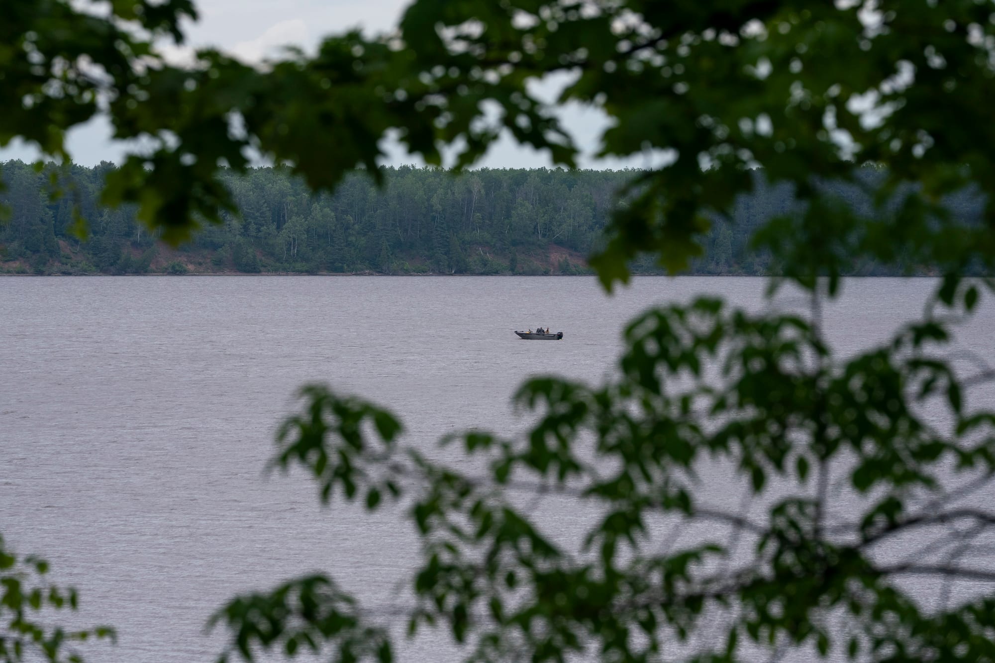
Protected bays, shallow areas, and islands provide safer places for sturgeon, muskies, northern pike, and walleye to feed, shelter, and spawn. They also provide places for migrating birds to rest and refuel and provide habitat for nesting birds and wildlife.
“More than 130 bird species use the estuary for some part of their life cycle,” said Jeramy Pinkerton, acting St. Louis River and Lake Superior team supervisor through the Minnesota Department of Natural Resources.
The number of pelicans, who often gather by the hundreds in Chambers Grove Park along the western end of the estuary, are going up, which likely means fish populations are increasing, he added.
Eilers of the St. Louis River Alliance has been a resident along the riverfront and witnessed firsthand the rise in wildlife as areas were restored. She spied bears and deer swimming in the water and watched otters swim near her kayak.
“We are not separate from nature. We are nature,” she said. “When we remember our connection to water, we are then able to reciprocate the love and care back to our rivers. And that will result in healthy communities.”
St. Louis River restoration projects
Here are a few of the dozens of restoration projects along the 12,000-acre St. Louis River Estuary in the last decade:
Radio Tower Bay: About 115,000 cubic yards of slab wood and wood pilings were removed from late 1880s lumber mills. That helped create deeper water for overwintering fish, such as bluegills and crappies.
Grassy Point and Kingsbury Bay: About 130,000 yards of waste wood was also removed from four long-ago lumber mills at Grassy Point, along with 140,000 yards of sediment from Kingsbury Bay. Dredged materials helped cap a new islands, which will provide more wildlife habitat and help shelter the bay.
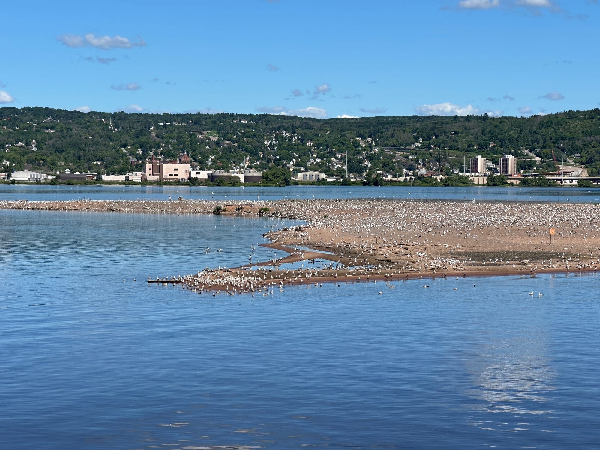
Interstate Island: This island and wildlife management area near the Blatnik Bridge and where the river meets the Twin Ports harbor was restored after high water levels shrunk its size. It’s one of two common tern nesting sites on Lake Superior. It can be seen on public Vista Fleet harbor cruises.
Perch Lake: This shallow 21-acre bay and nine acres of marsh habitat along Minnesota Highway 23 has been restored and reconnected to the St. Louis River. Parking and a handicapped accessible kayak landing are being added with a culvert under the highway large enough for paddlers to pass through and reach the river. Birders can look for Virginia rails, soras and rusty blackbirds from trails or the parking lot.
Mud Lake Causeway and railroad corridor: The volunteer-operated Duluth River Train (also known as the Lake Superior and Mississippi Railroad) celebrates its 45th anniversary in 2025. It has been back in action since 2023 after the COVID-19 pandemic and restoration work impacted its 5.2-mile route. Running weekends from late June through mid-October, the narrated train ride follows the St. Louis River with the chance to see restored areas up close. Passengers opting for a Choo Choo Paddle tour can get off at Boy Scout Landing (where the train stops and turns around) and kayak back to Spirit Lake Marina.
This story was edited and fact-checked by Jen Zettel-Vandenhouten.