School maps show promise as safety tool. Here's how they work.
Digital maps can help first responders in an emergency, if local school officials allocate the money to keep the technology in place and commit to updating the maps.
Minnesota school officials will soon have digital facility maps at their fingertips, part of a growing movement nationwide to increase security.
Minnesota lawmakers earmarked $7 million for school maps in 2024, administered by the state’s seven regional emergency communication boards. The law stipulates the initial $7 million is a one-time investment, and the money is available until June 30, 2026.
St. Cloud-based GeoComm made a push in recent years to map K-12 schools, said Jason Kim, the company’s senior director of growth marketing, and GeoComm submitted a bid for the regional contracts. But some experts say annual maintenance costs and ongoing updates could cause school districts to abandon the tools.
How it works
School district officials can upload their own maps to GeoComm’s program or have GeoComm staff map school buildings and grounds, Kim said.
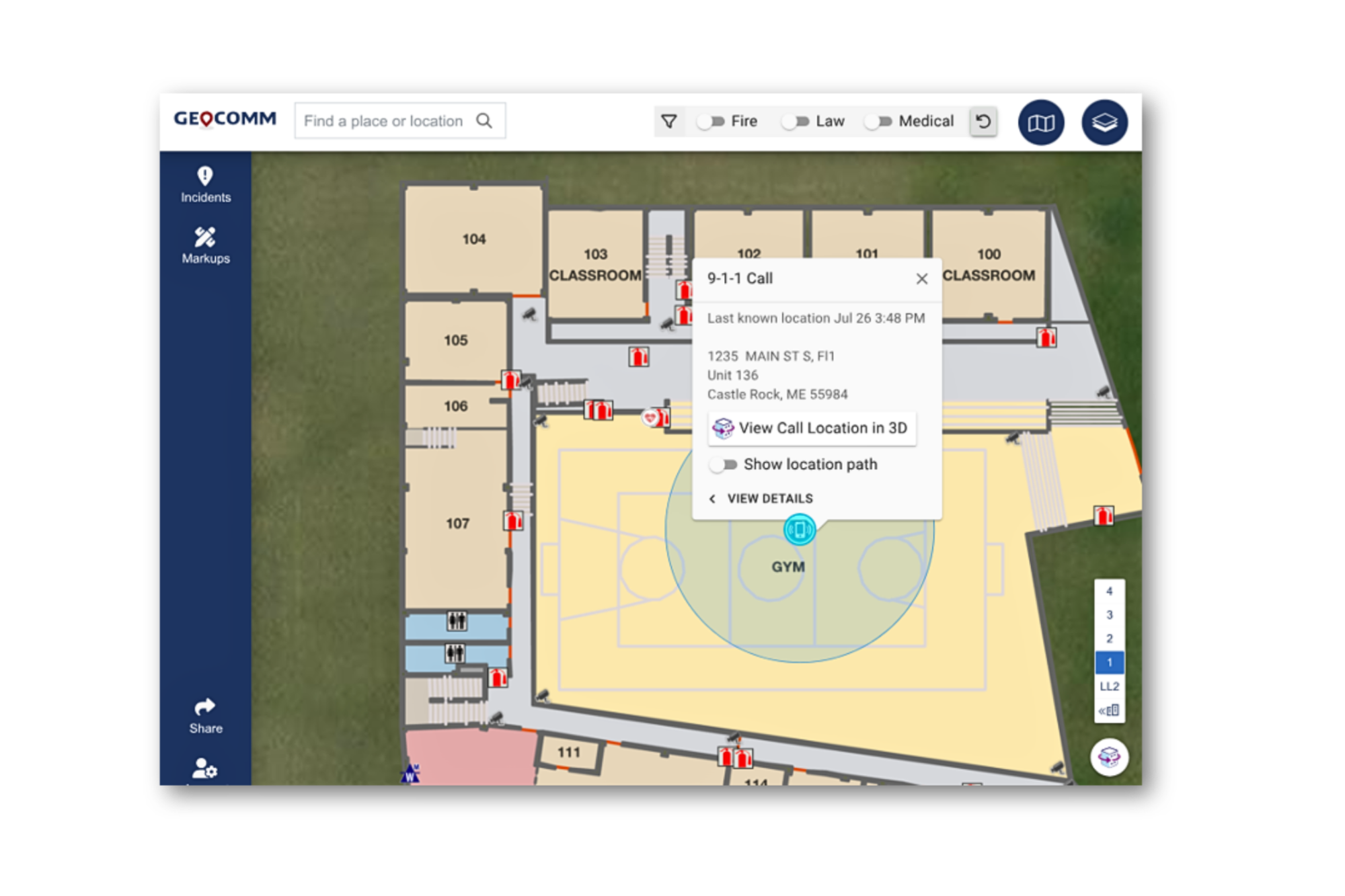
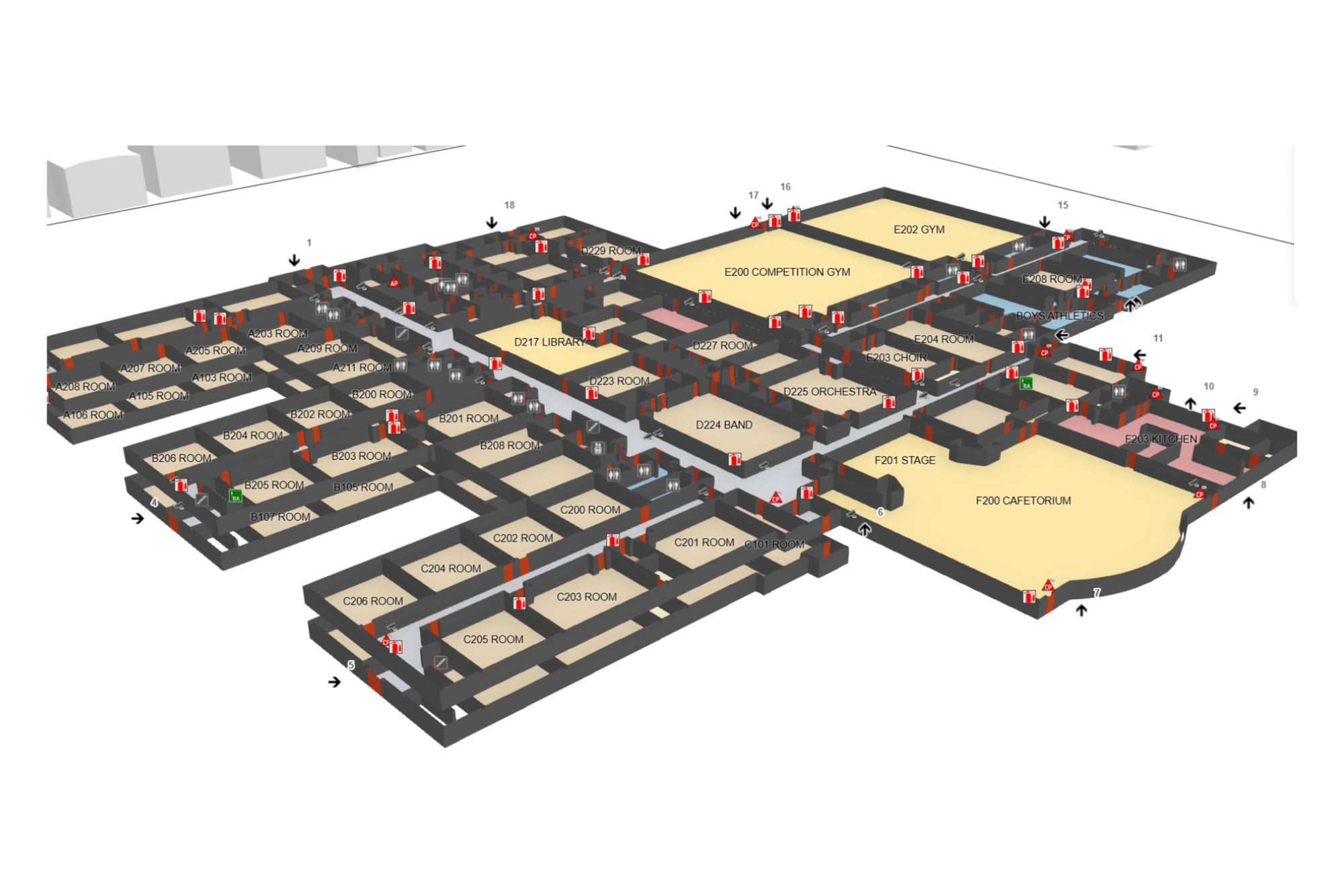
The software allows officials to be as detailed as possible – they can record where every fire extinguisher, automatic external defibrillator, doorway, and restroom are, for example.
Once the maps are set, school officials can share them with local law enforcement. This allows first responders to pinpoint the exact source of an emergency call in the building.
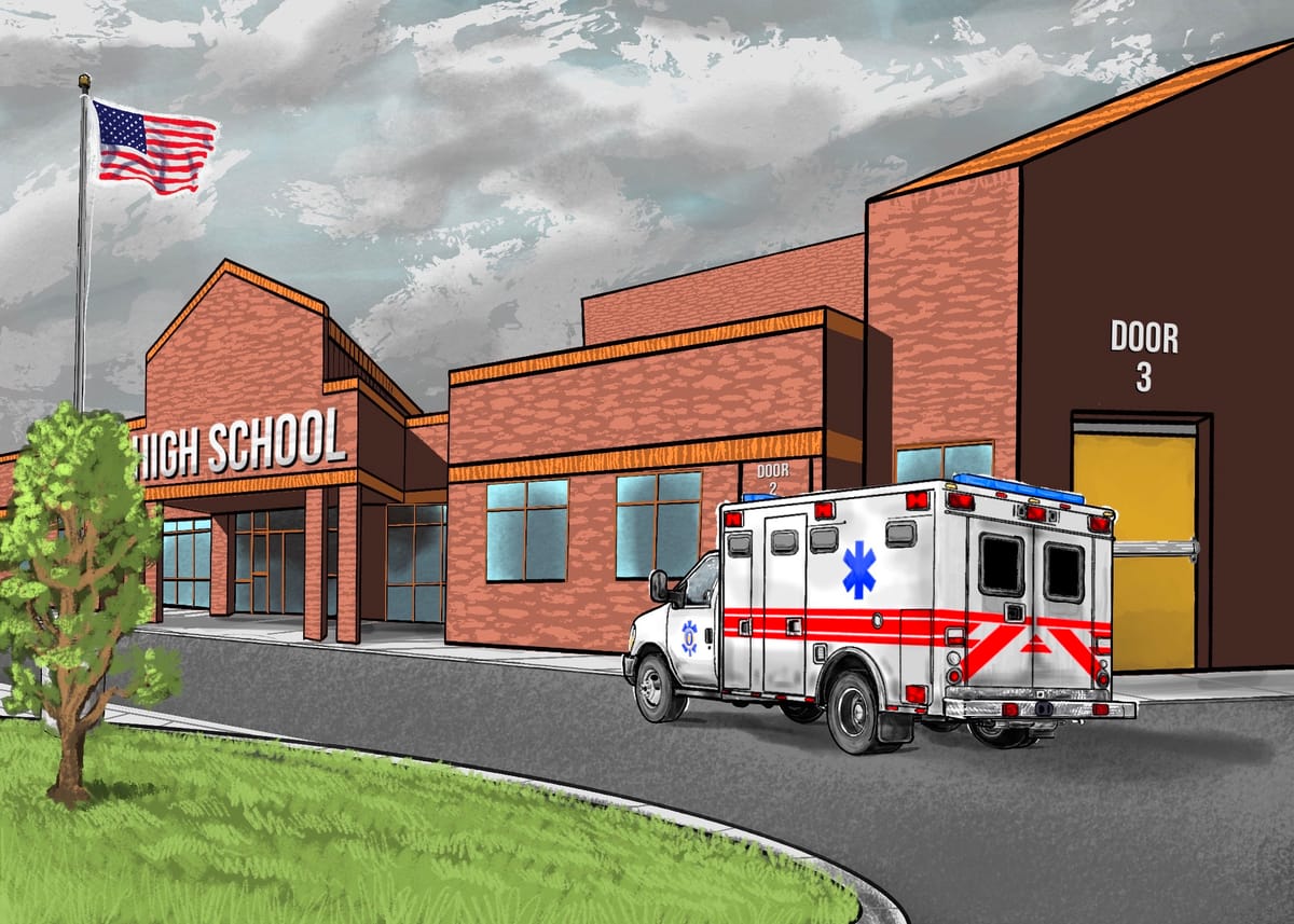
Kim cited a 2024 medical incident at Jackson County Central High School in Jackson, Minn. Emergency responders used GeoComm’s indoor map of the school to determine where the call came from and parked the ambulance at the nearest door, he said.
“It was really, I think for a lot of folks, very enlightening in terms of the impact of how these maps work, because so many folks are still used to using the PDFs and the CAD drawings (of schools),” he said.

School officials can update the maps in real time. Kim said some use the software for emergency preparedness during sporting events and graduations, for example.
On the security side, school officials set up tiers of access, said Bill McCullough, vice president of sales and marketing.
“Not everyone has the same access. A teacher wouldn’t necessarily have the same access as a security professional or a facilities professional or the superintendent of the school district,” McCullough said.
The system exists on the Amazon Web Services GovCloud, which McCullough said is one of the most reliable, secure networks available.

In practice
Kyle Jones is the deputy superintendent of Florence 1 Schools in Florence, South Carolina.
The school district has 16,400 students, Jones said, and started using GeoComm to map its buildings in 2023.
Officials mapped district buildings in phases: at their three high schools and alternative school in 2023-24; at their four middle schools in 2024-25; and the district’s 14 elementary schools will be next.
GeoComm’s maps “fit like Legos would fit together” with Florence 1 Schools security protocols, such as cameras, Jones said.
One thing Jones said is important to note is the time it takes when GeoComm staff come to map facilities. If GeoComm says it will take three days, they mean it will take three full days to detail every nook and cranny.
“You want to allocate staff that are able to stay with them – start to finish,” Jones said.
He appreciates how responsive GeoComm’s software is, the fact that it draws data from one source, how secure it is, and how it uses the same language and symbols first responders use.
So far, community members have not been critical of the software, and Jones said he couldn’t think of anything that needs to be improved.
“When you’re talking about student safety, that’s certainly a hard one to criticize,” Jones said. “I’d rather be as proactive as humanly possible.”
Florence 1 Schools recently renewed its contract with GeoComm. Jones told Project Optimist one year of service costs the district $22,550.
Statewide map contract awarded
GeoComm received a $6 million contract to map schools across the state of Iowa, and submitted a proposal to do the same in Minnesota. McCullough told Project Optimist that the southwest region emergency communications board awarded its school mapping contract to GeoComm. The six other regional boards consolidated under one RFP, McCullough said, and awarded the contract to Critical Response Group.

School officials who opt-in to have their buildings mapped will have to foot the bill for the technology after it’s implemented.
In the past, ongoing maintenance costs caused school districts to drop similar mapping programs, said Ken Trump, president of National School Safety and Security Services (no relation to President Donald Trump).
Trump, who has spent more than four decades in the school security industry, said he remembers similar mapping programs that appeared after the 1999 Columbine High School shooting.
“The devil rests in the details of fidelity of implementation and also the sustainability over time,” Trump said in an email to Project Optimist. “If schools get one-time grant money for these projects, which some vendors have reportedly been lobbying for, it is great in the eyes of school leaders – until they have to decide how to sustain the ongoing costs of subscriptions to software and other costs … and sustain the program for the long haul.”

Trump’s main questions about school maps include: who can access them and how quickly can they be accessed by first responders and/or 911 dispatchers?
“Generally speaking, there is not a problem with the concept or intent of mapping schools for emergency response purposes. It can potentially – emphasis on potentially – be a resource if a school shooting or other critical incident occurs,” he said.
This story was edited and fact-checked by Nora Hertel. It is part of a series on firearms in collaboration with Minnesota Women's Press.